Here is a Google video of part of the Conservation Commission meeting of 12/11/08 (also viewable at Vimeo video). This portion is two hours and 12 minutes long, and includes the presentation of proposed condos (25 units) off North Street by Kohl Construction, followed by public discussion and comments by members of the commission. Kohl proposed to place grading, walls, yards, patios, and certain components of the stormwater
management system as close as 12 feet to the wetland
on its parcel. This video was recorded by Lisa Boulerice.
The commission expressed discomfort with allowing much disturbance closer than 35 feet to the wetland. They continued the hearing to 6:15pm on Thursday, January 8. This hearing will take place in City Hall Hearing Room 18 (2nd floor, enter via the back door). Concerned citizens are urged to attend.
Meeting Highlights
0:31:10-0:55:00 Kohl Construction presents condo proposal with focus on stormwater management, takes questions from commissioners
0:55:01… Commission opens to comments from the public
0:55:16-1:06:10 Alan Seewald, attorney for the North Street Neighborhood Association, speaks to how the new wetlands ordinance is ambiguous about what it requires to permit encroachment within 50 feet of wetlands. The commissioners and Bruce Young (Land Use and Conservation Planner) discuss. Will Kohl’s proposal improve the wetlands?
1:06:11-1:12:20 Other members of the public make comments
1:12:21-1:15:03 Former City Councilor Alex Ghiselin, speaking about Northampton’s inspection and maintenance regime for stormwater mitigation: “It’s not clear to me now that we have an effective system or that it’s funded in any significant way, or that we’ve looked at the legal problems involved in long-term enforcement and inspection–who will be responsible over time. I have to tell you as somebody who represented a ward that has a considerable amount of wetlands, and building in those wetlands, that that was the knottiest, the most difficult problems that we dealt with… Once the houses are built there’s really no good solution. I think of on Winslow, on Nutting, on Elm Street, I think of a continual problem that has bedeviled people who have owned those houses. The developers are long gone. These are houses built 25-30 years ago. I think of my friends John and Sue Norton on Winslow, who spent in excess of $8,000 last year to move water around their house. Almost everybody on the northeast side of Winslow has that problem. It’s built along a series of wetlands and streams… I also think it’s also significant that the City Councilor with by far the most experience in this city, Jim Dostal, who worked for the DPW all those years, has personal experience with buildings built near and in wetlands, and the problems that they’ve produced for the city over time, was adamantly opposed to moving to within 10 feet, and is still adamantly opposed, and I hope that the City Council will revisit this. In the meantime, you should really move very carefully into this new area.”
1:15:04-1:17:37 Alan Seewald: “If you allow it here, you have to ask yourself, ‘What projects are you not going to allow?'”
1:17:38-1:56:14 More comments from public and Kohl Construction
1:56:15-2:12:22 Discussion among commissioners and Kohl Construction…
Commission Chair Paul Wetzel, “I don’t see that there should be a reason to move past the 35 foot line.”
Doug Kohl, “…at a certain point you have to ask, ‘Why was the bylaw written this way?’ There have to be some extraordinary measures that can be taken in some way that meet the bylaw in your mind.” Kohl offers to consider donating land elsewhere to compensate for the encroachment.Commissioner Mason Maronn, “Doing something on land somewhere else won’t help the situation here, so I don’t see that as an option. I have trouble getting past the 35 feet.”
Commissioner Downey Meyer, “I’m also not inclined to go below 35 feet. I also wonder why those who have spoken so quickly got to 50, since the state Wetland Protection Act and the city ordinance both protect to 100. So I think you’re being rather unambitious arguing from 50 to 35… I’m also, as Alex said, a little bit skeptical of the engineered solutions… Part of the reason why buffer zones have received greater emphasis in wetlands protection is that they do seem to work without anyone having to maintain them in terms of making the whole wetlands system work effectively. However, in terms of extraordinary mitigation, I think that to leave open what could happen within 35 feet, I think that depending on the size of the impact within the 35-foot boundary, then the extraordinariness of the mitigation would be in relation to that. Obviously here you have the creation of some of these detention ponds within the 35-foot area. If you were talking about pipes or drywells within the 35 feet, and there was some significant or extraordinary mitigation in relation to that minor incursion, that’s a different calculus… The extraordinariness of the mitigation is to be balanced against the size of the incursion. I would think that’s the only way the commission can look at it. They couldn’t just say, ‘There’s one extraordinary measure you must go through regardless of what you do within 35 feet…'”
The commissioners voted to continue the hearing to their January 8 meeting.
See also:
The Republican: “Neighbors challenge developer’s plan” (12/12/08)
In the first test of the city’s new wetlands ordinance Thursday, the Conservation Commission drew the line at 35 feet for encroaching into wetlands, sending developer Douglas A. Kohl back to the drawing board.
Kohl wants to build 25 townhouse units in a wooded area near North Street and Northern Avenue. Neighbors oppose the project, saying that it will adversely affect wetlands there and carve up one of the last remaining undeveloped parcels near downtown…
Some 25 people, most of them residents of the North Street neighborhood, jammed the hearing room at City Hall. Many said their basements flood and fear further development will exacerbate flooding…
Kohl Construction Applies for Special Permit and Site Plan Review
(11/20/08)
Northampton Residents Sue Developer Douglas Kohl to Resolve Questions
of Title and Rights-of-Way (3/13/08)
Report on Kohl’s Property by Alec MacLeod, Environmental Scientist: Indications of Vernal Pool Habitat
This site is particularly difficult to delineate, as the differences
between areas meeting the technical definitions of hydrophylic plant
communities and hydric soils are very slight over much of the site. Mr.
Dauchy and I examined literally hundreds of soil samples along all the
wetland boundaries and discussed the degree to which the soils along
the boundary either did or did not display the colors and other
features necessary to define the soil at that location as hydric.
Just Released: Planner’s Guide to Wetland Buffers for Local Governments (emphasis added)
[Environmental Law Institute:] Larger buffers will be more effective
over the long run because buffers can become
saturated with sediments and nutrients, gradually
reducing their effectiveness, and because it is much
harder to maintain the long term integrity of small buffers.
In an assessment of 21 established buffers in two
Washington counties, Cooke (1992) found that 76%
of the buffers were negatively altered over time. Buffers
of less than 50 feet were more susceptible to degradation
by human disturbance. In fact, no buffers of
25 feet or less were functioning to reduce disturbance
to the adjacent wetland. The buffers greater than 50
feet showed fewer signs of human disturbance…
Enacted local government buffer ordinances show
a wide range of wetland buffer dimensions. The lowest
we found was 15 feet measured horizontally from the
border of the wetland, with the highest approximately
350 feet. Several ordinances set 500 feet as a distance
for greater regulatory review of proposed activities, but
do not require nondisturbance at this distance. Often
the ordinances provide a range of protections, with
nondisturbance requirements nearest the wetland and
various prohibitions and limitations as the distance
from the wetland increases. Among the ordinances we
examined, the largest number of ordinances clustered
around nondisturbance or minimal disturbance buffers
of 50 feet or 100 feet, with variations (usually upward
variations) beyond these based on particular wetland
characteristics, species of concern, and to account for
areas with steeper slopes.
City Council Enacts New Wetlands Ordinance, Including 10-Foot Buffers
Councilor Dostal proposed two amendments to the ordinance, but neither
was approved by the majority. One amendment called for compensating
landowners whose use of their land would be restricted by the vernal
pool regulations in the new ordinance. The other called for 50-foot
no-disturbance wetlands buffers throughout the city, with an exception
for industrial and business districts representing 5% of Northampton’s
land area. In those districts, 10-foot buffers would have been
permitted in exchange for extraordinary mitigation or open space
preservation measures. We applaud Councilor Dostal’s attempt to reduce
the risks of narrow buffer zones, especially for those who reside in
Northampton’s urban areas. On this latter amendment, he was joined in
support by Councilor Raymond LaBarge.
During the discussion of
the ordinance, Conservation and Land Use Planner Bruce Young asserted
that wetlands buffer zones were less important in Northampton’s more
built-up areas, as opposed to those on the outskirts. This seems
plausible with respect to wildlife and natural habitats. The wetlands
in-town tend to be hemmed in, surrounded by disruptive human
activities, and more fragmented. Some are degraded with invasive
species and man-made materials such as masonry.
We believe, however, that our in-town buffers are more important than average when it comes to flood mitigation and water pollution. A disproportionate percentage
of the people and property of the city are found in the areas now
subject to 10-foot wetlands buffers. Our drainage systems there are
already under stress. Flood damage reports from Tropical Storm Floyd show clusters of red flags in our urban areas, even under the previous, more restrictive buffer zone regime.
It
also stands to reason that stormwater runoff, with its chemicals, oils,
sand, silt, and other contaminants, is a more serious issue in our more
urban areas, with their large concentrations of human activity, cars
and impervious surfaces. Narrow wetlands buffers will enable that
pollution to enter our streams and rivers more quickly, with less
processing, and in higher volumes. This runs contrary to the spirit of
the Connecticut River Strategic Plan
(2003), which “proposes the removal of impervious surfaces within 50
feet of streams…” As former Councilor Alex Ghiselin observed during
the public comment period, cleaning up the Connecticut River has been
one of the region’s signal achievements during the past generation.
It’s a shame to imperil this work.
Gazette: “Council adopts wetlands ordinance”
At-large
City Councilor James M. Dostal proposed an amendment Thursday that
called for increasing the 10 feet no-encroachment zones in urban
residential districts to 50 feet because of serious concerns about
homes flooding, saying “We shouldn’t be building there…”
Alex Ghiselin, Letter to Gazette: “Don’t let development encroach on our wetlands”
The
failure of the storm water system built as a part of the Northampton
High School renovation six years ago illustrates why protecting
wetlands is so important. Silt has filled the retention pond so there
is no capacity to slow a storm surge which now flows unimpeded into the
Mill River and contributes to flooding downstream. This accumulated
silt also raised the water table and spills ground water into nearby
basements…
Without maintenance, these [storm water mitigation] systems are part of the problem, not the solution…
Wetlands do not need to be maintained; they just need to be protected.
Carlon Drive: Compensatory Wetland Not Working
Mike Kirby writes:
In
Carlon Drive, they simply scooped out a hole in the swamp-bottom, and
called it a detention structure. Today it is just a pond, and a
stagnant smelly one. It was designed to have a dry forebay, and a
shallow main chamber was supposed to have only about 6 inches of water
in it. This was supposed to be a compensatory wetland, full of cattails
and wildflowers. A rock check dam was supposed to hold back the “first
flush” off the parking lots and trap pollutants, and outflow from it
was supposed to feed the wet part of the detention pond. Here rain
water pouring off the new parking areas and street was supposed to be
stored, and discharged safely.
That was the plan. Today if you
stand by the pond and look down into it, you’ll see the check dam is
now about two feet underwater. You can’t even see where they planted
the marshgrass and flowers. The area is under water. Even in a fairly
dry summer, the detention pond is only about a foot and a half from the
top of the bank. There’s no storage to speak of, no discharge, no
filtering. As it is constructed now, grey water from the parking lots
and the access street goes directly into the swamp and the Connecticut
River.
Photos Show: Man-Made Lakes and Stormwater Retention Systems
Are No Substitute for Natural Wetlands
“Everett stands at the edge of a murky stormwater retention pond in Ivy
Hall that Everett said was once a forest-lined isolated wetland. While
the low grass held carnivorous sundew plants, the stump-filled water
was largely devoid of visible aquatic life. ‘This looks awful,’ she
said…”
“A
band of white pollutants and algae float at the top of a stormwater
retention pond at Belle Hall Plantation. Though created to handle
pollution and often full of mosquito larvae, this type of pond is
considered a functioning wetland under definitions by the U.S.
Department of the Interior.”
Boxborough Wetlands Regulations: Plans that Require Replication Discouraged
The
history of wetland replication is mixed. Scientific reviews [Brown,
S&P Veneman, 1998] conclude that for the most part replications
fail to reproduce the range of values–in quantity and quality–of the
wetlands they are intended to replace, in particular, difficulties in
replicating proper hydrological conditions in a consistent and enduring
fashion seem to be a major source of the problem.
The Commission shall strongly discourage any plan that requires wetland replication…
Benefits of Urban Wetlands and Their Buffer Areas
In their Wetlands Request for Determination of Applicability
(PDF) filed with the city last month, Kohl Construction portrays the
wetlands between North Street and the bike trail as “degraded”, partly
because there’s a grain of truth to this and partly (presumably) to
make people feel less bad about development in this area.
Kohl’s Area Description:
The area of the two parcels combined is approximately 5 acres. There is
an intermittent stream that flows from the north, through a culvert
under the new bike path. The stream is also fed by the storm drain
system on Northern Avenue, which flows into the swale adjacent to the
bike path. There are bordering vegetated wetlands associated with the
intermittent stream. The wetlands are degraded with masonry and other
construction and road building debris, as well as invasive plant
species.
While it’s true that fill from past work on
Market Street was dumped into these wetlands, nature has been hard at
work reclaiming this space. For example, we believe the hummock towards the back of this picture is one of the main piles of fill in the area:
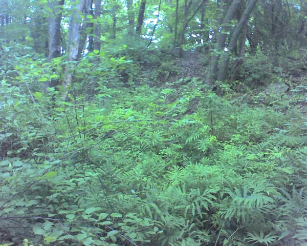
Photo Essay: Our Woods in Fall
Photo Essay: Arbor Day and the North Street Woods
Photo Essay: Millyard Brook Swells with Water in Winter