These Belchertown Wetlands Regulations, dated May 23, 2006, may provide guidance as Northampton debates its own regulations. It notes the benefits wetlands provide and regulates development that encroaches within 100 feet of a wetland. Developers are required to model watershed behavior during 2-, 10- and 100-year storms. Regulations of vernal pools are integrated into the general discussion of wetlands and buffer zones. This appears to make more sense than treating them separately, which is what Northampton’s City Council is preparing to do on September 6.
Here are excerpts from Belchertown’s regulations with emphasis added:
POLICIES:
No Net Loss: It is the policy of the Belchertown Conservation Commission to follow the “No Net Loss” guidelines set forth by the Massachusetts Department of Environmental Protection. Therefore, applicants who propose to alter Resource Areas under the Commission’s jurisdiction must:
demonstrate that there is no practicable alternative,
minimize impacts where they are unavoidable
mitigate losses of Wetland Resource Areas, where applicable or appropriate, on at least a 2:1 basis, (2 parts replicated to 1 part lost). “Limited projects” are included in this requirement.
No Net Change in Stormwater Runoff: It is the policy of the Belchertown Conservation Commission to require applicants to demonstrate that no significant change in off-site runoff will result from proposed work. Because increased runoff impacts land downstream and reduces natural groundwater recharge, the Commission may require measures (such as Stormwater detention basins) to prevent increased runoff. Direct discharge of runoff into a Resource Area will not be allowed.
Stormwater Management: The Town of Belchertown adopts the DEP Stormwater Management policy and all nine management standards. For the purpose of these Regulations, all Buffer Zones and Wetland Resource Areas will be considered critical areas and all drainage calculations and all storm water runoff to be treated for water quality must be based on the following calculation: 1 inch of runoff x total impervious area of post-development on the site.
The Town of Belchertown will presume that projects that meet the nine Stormwater Management Standards satisfy regulatory requirements. When one or more of the Standards cannot be met, an applicant may demonstrate that an equivalent level of environmental protection will be provided.
Resource Areas: The Conservation Commission has determined that certain additional areas of jurisdiction are significant to the protection of interests identified in the Belchertown Wetlands Bylaw. The Commission presumes that the following additional Resource Areas are significant to those interests:
1. Isolated Wetlands greater than 5,000 sq. ft.
2. Ponds greater than 5,000 sq. ft.
3. Ephemeral Pools.
These presumptions are refutable and may be overcome upon a clear showing that said land does not play a role in the protection of interests identified in the Bylaw. In addition, it is the policy of the Commission to advise applicants on three non-regulated Wetland Resource Areas:
1. Intermittent Streams up-gradient of Wetland Resource Areas
2. Isolated Land Subject To Flooding below 310 CMR 10:57 size thresholds
3. Isolated Wetlands less than 5,000 sq. ft.
The applicant shall identify these areas at the site, locate them on the plans, avoid impacts to these areas and will mitigate unavoidable impacts with respect to drainage and flood control…
6. Vegetated Buffer Strip: Development proposed in the Buffer Zone can negatively impact the abutting Resource Areas(s). Negative impacts, both from the “construction” and “use” phase of the project can include erosion, siltation, loss of pollution attenuation, loss of groundwater recharge, reduced water quality and loss of wildlife habitat. A minimum 25ft. strip of continuous, undisturbed, indigenous vegetative cover, (no disturb area), along the Resource Area boundary within the 100 ft. Buffer Zone shall be maintained, in order to protect the adjacent Wetland Resource Areas, and provide wildlife habitat. All footing drains and drainage outlets must stay out of the 25ft. no-disturb area. In addition, The Conservation Commission requires all applicants to submit an alternative analysis, demonstrating need and justification for any work proposed within the 25 ft. to 50ft. no-disturb Buffer Zone area. The applicant shall prove by a preponderance of the evidence that there are no practicable and substantially equivalent economic alternatives to the proposed project with less adverse effects on any Wetland Resource Areas. A practicable alternative means a measure that is available and capable of being done after taking into consideration cost, existing technology, and logistics in light of overall project purposes. A larger buffer may be required in sensitive areas, such as but not limited to, steep slopes, critical areas and highly erodable soils.
7. Request for Determination versus Notice of Intent: Many times applicants are confused regarding when to file a Request for Determination and when to file a Notice of Intent for work in the Buffer Zone. For a project to be issued a Negative Determination, the Commission must be assured that the potential for alteration of a Resource Area is so insignificant as to not require the oversight provided by an Order of Conditions and subsequent Certificate of Compliance. Therefore, the Commission may typically consider issuing a Negative Determination to projects that meet the following minimum criteria:
* No alteration of a Wetland Resource Area
* Less than 2,500 sq. ft. of alteration in the Buffer Zone
* No work will occur within 50’ of a Wetland Resource Area.
* The slope within the buffer zone must be no steeper than 15% (6.7 to 1 slope)
* Not in the Buffer of Endangered Species Habitat
* A plan is included for permanent stabilization-including loaming, seeding, and mulching
* Erosion control measures are maintained until permanent vegetation is established
Consultants: The Commission reserves the right, as stated in the Belchertown Wetland Bylaw, to require third party verification of all submittal information and to require an applicant to pay a fee for the reasonable costs and expenses borne by the Commission for specific expert engineering and other consultant services deemed necessary by the Commission to come to a final decision on the application. The Commission will hire at the applicant’s expense a consultant(s) to review part or the entire submittal. This fee is called the “consultant fee”. Such consultant fees should be reasonable and/or appropriate to the work undertaken. The specific consultant services may include, but are not limited to, performing or verifying the accuracy of Resource Area surveys and delineations; analyzing Resource Area functions and values, including wildlife habitat evaluations, hydro-geologic and drainage analysis, review applications and plans and researching environmental or land use law. Failure to compensate the Commission’s consultant(s) in a timely manner will result in the application being deemed incomplete and/or the issued permit being null and void.
BWR 10:01 VALUES PROTECTED BY THE BELCHERTOWN WETLANDS BYLAW:
The following are the values under the Belchertown Wetlands Bylaw:
· Protection of public and private water supply
· Protection of groundwater and groundwater quality
· Protection of surface water and surface water quality
· Flood control
· Storm drainage prevention
· Prevention of pollution
· Protection of fisheries
· Protection of wildlife habitat
· Erosion and sedimentation control
· Storm drainage
· Protection of agriculture and forestry
· Protection of aquaculture
· Recreation
· Preservation of open space
BWR 10.02 AREAS OF JURISDICTION:
(1I) Areas Subject to Jurisdiction under the local Bylaw: Except as permitted by the Conservation Commission or as provided for in the Bylaw, no person shall remove, fill, dredge, build upon, or alter the following RESOURCE AREAS:
(A) any freshwater Wetland, over 5,000 [square feet] in size, as determined by vegetational community, soil composition, and/or hydrologic regime, including Isolated Wetlands, and any marsh, wet meadow, bog or swamp;
(B) any pond, lake, river, any Perennial or Intermittent Stream;
(C) any land under such waters;
(D) any bank or beach;
(E) any land subject to flooding or inundation by groundwater, surface water, storm flowage;
(F) any Ephemeral Pools, Vernal Pools;
or within 100 feet of the above Resource Areas, an area known as the BUFFER ZONE to the Resource Areas.
(F) any Bordering Land Subject to Flooding
(G) Riverfront Area, because the State has established a 200 ft. setback on each side of a perennial stream, river or brook, the Commission recognizes the need to protect this area. For the purpose of administrating these regulations, the Commission has adopted the States definition and jurisdiction of the Riverfront Area…
BWR 10:04 DEFINITIONS:
The definitions applicable to the Belchertown Wetlands Bylaw shall be the same as set forth in the Wetland Protection Act, MGL c. 131,s. 40 and the Wetland Protection Regulations 310 CMR 10:00 et. Seq. except for the purpose of administrating these regulations, the Commission has adopted the following modifications and additional definitions:
Alter: Alter means to change the condition of any area, either temporary or permanent, subject to jurisdiction under the Bylaw. Examples of alteration include, but are not limited to, the following:
* removal, excavation or dredging of soil, sand, gravel, or aggregate materials of any kind;
* changing or modifying pre-existing drainage characteristics, flushing characteristics, salinity distribution, sedimentation patterns, flow patterns, or flood retention characteristics;
* drainage or other disturbance of water level or water table;
* dumping, discharging or filling with any material which may degrade water quality;
* placing of fill, or removal or material, which would alter elevations;
* driving of piles, erection or repair of buildings, or structures of any kind;
* placing of obstructions or objects in water;
* destruction of plant life including cutting of trees;
* changing water temperature, biochemical oxygen demand, or other physical, chemical or biological characteristics of surface and/or groundwater;
* excavation for the purpose of percolation or deep hole testing or the crossing of a Resource Area with heavy equipment for this purpose;
* any activities, changes, or work which may cause or tend to contribute to pollution of water or groundwater;
* shading…
Engineering calculations:
1. Engineering calculations are required to show the effect of the proposed activity on soil and water, Calculations and watershed modeling shall normally be performed using a hydrograph analysis based on the techniques developed by the USDA, Soil Conservation Service. Calculations shall be made that show the impact for 2-year, 10-year, 100-year storms using the SCS Type II or III 24 hour rainfall, or other storms consistent with the Belchertown Planning Board policy (Subdivision Regulations, Sec. 5.4.8). A registered professional civil engineer or qualified hydrologist shall prepare the calculations. All plans and data submitted must be signed and stamped by a registered professional civil engineer or any other appropriate professional…
Alteration of any Wetland Resource Areas and/or the 25 ft. no disturb area requires the applicant to submit a Wildlife Habitat Evaluation report. In addition, alteration of any Wetland Resource Area and/or work within the 50 ft. of the Wetland Resource Area shall require an Alternative Analysis, (excluding Bordering Lands Subject to Flooding and/or Riverfront Area, because no buffer zone area exists.)
…Performance Standards: A proposed project, which may result in alteration of an Isolated Wetland, shall not result in the following:
(A) Flood damage due to filling which causes lateral displacement of water that would otherwise be confined within said area
(B) An adverse effect on public and private water supply or ground water supply, where said area is underlain by pervious material
(C) An adverse effect on the capacity of said area to prevent pollution of the ground water, where the areas is underlain by pervious material, which in turn is covered by a mat of organic peat or muck
(D) An impairment of its capacity to provide important wildlife habitat…
An Ephemeral Pool boundary shall be determined using a combination of pooled water, if present, and by the presence of a depression covered by water-soaked leaves, water marks or lack of moss on trees, buttressed tree trunks, shallow-rooted trees, or adventitious roots on trees. Other indicators of the temporary pooling of water, such as the presence of caddis fly cases or fingernail or pea clams, can also be used. The burden of proof for identification of an Ephemeral Pool shall be upon the Conservation Commission. Identification shall follow the guidelines for Vernal Pool Certification Criteria established by the Massachusetts Division of Fisheries and Wildlife. In the case of disputes, hydrological calculations using the 2-year storm may be used to provide a determination of the boundary of an Ephemeral Pool.
III. Presumption. Where a proposed activity involves the removing, filling, dredging or altering of an Ephemeral Pool, the Conservation Commission shall presume that such an area is significant to the protection of wildlife habitat, particularly amphibian breeding habitat. This presumption is rebuttable and may be overcome upon a clear showing that the Ephemeral Pool does not play a role in the protection of wildlife habitat. In the event that the presumption is deemed to have been overcome, the Commission shall make a written determination to this effect, setting forth its grounds.
The Conservation Commission shall presume that an Ephemeral Pool is significant to the protection of wildlife habitat, particularly amphibian breeding habitat. Therefore, the removing, filling, dredging or altering of an Ephemeral Pool or a 100’ buffer shall not be allowed. This presumption is rebuttable and may be overcome upon a clear showing that the Ephemeral Pool does not play a role in the protection of wildlife habitat. In the event that the presumption is deemed to have been overcome, the Commission shall make a written determination to this effect, setting forth its grounds.
IV. General Performance Standards. A proposed project in a Ephemeral Pool area shall not result in the following:
(A) any impairment of the capacity of the Ephemeral Pool as well as the area within 100’ of the mean annual boundary of the Ephemeral Pool to provide wildlife habitat. Alterations may be permitted if they will have no adverse effects on wildlife habitat, as determined by the procedures listed in 310 CMR 10:60
(B) endangering state-listed species, which shall be protected under the procedures listed in 310 CMR 10:59.
VERNAL POOL: The Conservation Commission shall presume that a Vernal Pool is significant to the protection of wildlife habitat, particularly amphibian breeding habitat. Therefore, the removing, filling, dredging or altering of a Vernal Pool or a 100’ buffer shall not be allowed. This presumption is rebuttable and may be overcome upon a clear showing that the Vernal Pool does not play a role in the protection of wildlife habitat. In the event that the presumption is deemed to have been overcome, the Commission shall make a written determination to this effect, setting forth its grounds.
BWR 10:81 BUFFER ZONE:
Preamble: It is the Commission’s experience that any project undertaken in close proximity to a Wetland Resource Areas has a high likelihood of resulting in some alteration of that area, either immediately, as a consequence of construction, or over a longer period to time, as a consequence of daily operation of the completed project. These negative impacts from construction, as well as long-term use, in the buffer zone can include erosion, siltation, loss of groundwater recharge, poor water quality characteristics and loss of wildlife habitat. The Commission’s prime concern in the Buffer Zone is the ultimate impact on the adjacent Wetland Resource Area from both the “construction” and “use” phases of the proposed activity. The policy of the Commission is to have the applicant maintain a strip of continuous, undisturbed, indigenous vegetative cover in the Buffer Zone adjacent to the Resource Area to reduce erosion and pollution to the adjacent Wetland Resource Areas, maintain water quality, improve water recharge and provide wildlife habitat.
II. Definition, Critical Characteristics and Boundary:
(A) Definition: The Buffer Zone is that area of land extending 100 feet horizontally outward from the boundary of any Resource Area specified in section BWR 10:02 (I).
(B) Critical Characteristics: Where surface runoff or groundwater from the Buffer Zone drains toward the resource area, vegetative cover and soils may filter runoff and provide uptake or renovation of pollutants from adjacent areas, thereby protecting water quality within the resource area. The vegetation and soils may slow surface runoff and permit infiltration of precipitation, maintaining the hydrologic regime to which the Resource Area is adapted. Indigenous vegetation is often used by wildlife for important functions such as nesting, feeding, and protective cover sites. Dense under story in wooded areas may provide nesting site, travel corridors and protective cover for a wide variety of fauna. Cutting of vegetation, especially canopy trees, alters the physical environment by allowing more light and air, and may increase temperatures during the summer and decrease temperatures in winter.
III. Presumption:
A minimum of a continuous twenty-five foot (25’) VEGETATED BUFFER STRIP between development activities in the buffer zone and the Resource Area to be protected, shall be presumed, is rebuttable and may be overcome upon a clear showing that said land will not play a role in the protection of said interests. The Conservation Commission requires all applicants to submit an alternative analysis, demonstrating need and justification for any work proposed within the 25ft. to 50ft. no-disturb area. The applicant shall prove by a preponderance of the evidence that there are no practicable and substantially equivalent economic alternatives to the proposed project with less adverse effects on any Wetland Resource Areas. A practicable alternative means a measure that is available and capable of being done after taking into consideration cost, existing technology, and logistics in light of overall project purposes. A larger Buffer may be required in sensitive areas.
In the event that the presumption is deemed to have been overcome, the issuing authority shall make a written determination to this effect, setting forth the grounds.
The following activities within the 25 foot vegetated buffer strip shall be presumed not to be significant to interests specified in the Preamble above.
(1) on-going landscaping activities legally permitted or grand-fathered, (prior to date of Wetland Regulations, 1-1-1992) on existing developed lots (continued mowing, landscape plantings, and selective pruning) provided that soil is not exposed to erosion, there is no change in grade, and sod cover or natural litter layer is maintained.
(2) construction or installation of fences or structures not requiring a building permit.
(32) maintaining existing construction of footpaths of minimum size.
Water-dependant activities, “limited projects” approved by the Commission, and activities where there is no practicable alternative, may be allowed by the Commission, where impacts are minimized and mitigated, as necessary. As with any work in the Buffer Zone, these activities still require the filing of a Request for Determination of Applicability, or Notice of Intent, whichever is appropriate under these Regulations.
IV. Performance Standards:
(A) Any work within the Buffer Zone shall not result in alteration of any Resource Area; or
(B) If any work within the Buffer Zone, which alters a Resource Area is permitted by the Commission, the alteration of the Resource Area shall comply with the applicable performance requirements for the altered Resource Area and any other conditions the Commission may require to enforce those performance requirements.
(C) Unless as specified above, a minimum of a continuous twenty-five foot (25’) NO DISTURBANCE VEGETATED BUFFER STRIP, untouched and in its natural state, shall be left between development activities in the Buffer Zone and the Resource Area to be protected.
(D) Any drainage outletting in the Buffer Zone shall be shown to be non-erosive and shall demonstrate there is not significant change in off-site runoff from the proposed work.
See also:
Kohl’s Condo Proposal: Where Things Stand, and What You Can Do
Kohl Construction proposes to build 31 condo units in the forest between North Street and the bike path. This development, with its access roads and 66 parking spaces, will claim 5.49 acres of land….
A wetland centered on Millyard Brook runs through the heart of the forest. The buffer area around a wetland is important in itself, an edge zone of high species diversity that helps regulate water flows into the wetland. These areas are fragile, can take a long time to establish, and are easily disturbed by development. The consequences of development around wetlands are often increased flooding in wet periods and more severe dryness during droughts.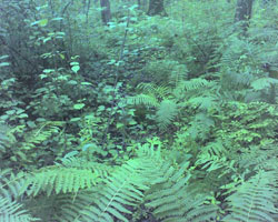
Ferns flock to moist areas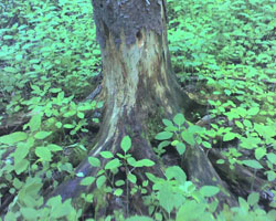
Exposed roots suggest that substantial volumes of water flow over this ground