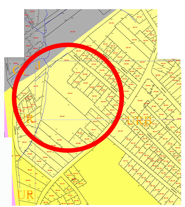
Here for your convenience is a map of the lots that abut Kohl Construction’s proposed condo project behind North Street. Kohl’s primary landholdings are the two large lots in the red circle, 25C-012 and 25C-017. A larger version of this map can be downloaded as a PDF.
The large lot in the upper portion of the map, 25A-166, is protected open space owned by the Commonwealth of Massachusetts. A forested wetland area, it looks nearly identical to the wetland portion of Kohl’s property, divided from it only by the bike trail that runs from Bates Street to Woodmont Road.
The bike trail, surrounded by trees and wetlands on both sides…
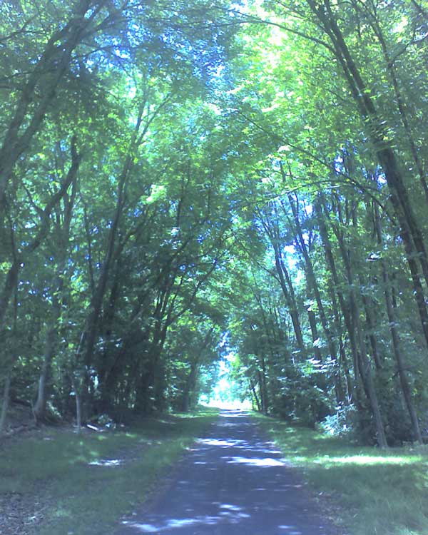